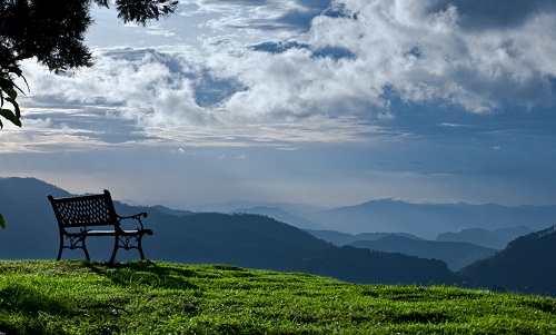
Upcoming Hill Stations

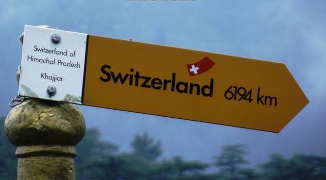
Mini switzerland of India: Why go to Europe when India offers much more

Khajjiar, often called "Mini Switzerland", is a small grassy meadow located in the picturesque Chamba valley. It is an important picnic spot whose quiet environs beacon the tourists traveling between Dalhousie and Chamba.It is also referred as the "Gulmarg of Himachal Pradesh".It is popular destination with trekkers too. The hamlet serves as the starting point for treks to Chamba, Dalhousie, Kalatop Wildlife Sanctuary, etc.

10 unknown Indian hill stations that you should visit soon

There are several hill stations in India that are popular among people like Shimla, Nainital, Ooty, Darjeeling etc. but there are many other hilly areas in India that are not only good but even better than these popular destinations. These unknown hill stations are less crowded, comparatively clean and offer scenic beauty. In this blog we want to highlight some really good hill stations that are not popular but are really good options if you want to visit a hilly area in near future. We highly recommend visiting these places in our next vacation.

Ladakh

Ladakh, bordered by the Karakoram chain of mountains in the north and the Himalayas in the south, is consisting of two districts Leh and Kargil. It is popularly known as “Little Tibet” as its culture is highly influenced by Tibetan culture.

It is fast gaining popularity as an amazing tourist destination of India, with the great Indus flowing right through Ladakh, the province is divided into Leh, the capital, Nubra, Zanskar, lower Ladakh and Rupshu. It is a land of mesmerizing beauty offering great opportunities of adventure sports.

Image Credit:

http://www.flickr.com/photos/29487767@N02/2771641153/
http://www.flickr.com/photos/ksriram/5937046855/
http://www.flickr.com/photos/madpai/249373723/in/set-72157594287392884

Kalpa

Kalpa, situated in the lap of Kinner Kailash peak, is a small town blessed with some of the most spectacular and beautiful landscapes. The place provides a clear view of the sacred Kinner Kailash peak as well as its sister peaks. It is a travellers paradise - lofty snow peaks, deep gorges, lush green valleys, fast flowing rivers, enchanting mountain lakes, flower bedecked meadows, beautiful temples and monasteries steeped in time. The place can be reached after crossing the quaint town of Recong Peo, which has a hundred-year-old monastery.

Image Credit:

http://www.flickr.com/photos/73515347@N03/6669881637/
http://www.flickr.com/photos/indiauntravelled/6742591653/
http://www.flickr.com/photos/vran/519570403/

History

Ancient Indian texts like the Puranas placed the people of Kinnaur as halfway between men and gods. Other ancient traditions speak of the exile of the Pandavas and the time they spent in Kinnaur, an episode from the epic, Mahabharata. In verifiable history, Kalpa, like the rest of Kinnaur, was a part of the erstwhile princely state of Bushair. From their original seat in the village of Kamru, the rulers moved out to Sarahan that lies lower down the Satluj, and then to Rampur - which is built right on the banks of the river. In the early nineteenth century, when the Gurkha’s spilled out of the borders of nearby Nepal, they captured large tracts of present-day Himachal Pradesh. Bushair also fell into their hands and the infant ruler was scurried to safety in Kinnaur. With their growing power, the British intervened, the Gurkhas were expelled and the treaty of Sagauli was signed in 1815-16. Most of the original rulers were restored their seats, and the British presence in the area was firmly established.

Kinnaur relapsed into secluded splendor till the British Governor-General of India, Lord Dalhousie set about creating the ambitious Hindustan-Tibet Road in 1850. Dalhousie himself travelled to Kalpa, then called Chini, was enamored by the beauty and climate of the area.

With the coming of India’s independence in 1947 and the creation of the state of Himachal Pradesh in 1972, geographic isolation steadily eroded. Hydro projects, the spread of education and economic growth with scientific horticultural practices began bringing their own changes. Relaxation of the Inner Line Permits in the mid nineteen-nineties, Kinnaur was opened to tourism.

Accessibility

Air: Nearest Airport (267 km) and Railhead (244 km) is at Shimla. Shimla''s Jubbar Bhatti airport is the closest at 260 kms. From here make the 10 hour journey by road to Kalpa either by private taxi or bus.

Rail: Shimla is the closet railhead at 240 kms. Take a bus or hire a taxi to make the arduous but very picturesque drive up to Kalpa.

Road: The route is on NH - 22 (The Hindustan Tibet Road) which bifurcates to Kalpa from Powari. Buses and Taxis are available at Shimla and Rampur. One can also reach Kalpa via Manali - Rohtang Pass - Kunzam Pass - Kaza (400 km).

Shopping

The visitors can buy Kinnauri shawls and caps from the Handicrafts Emporium in Kalpa. Kalpa has earned its name because of good quality Chilgoza, which grow over here in abundance.

Take home Kinnauri shawls and caps from the Handicrafts Emporium in Kalpa. Kalpa has earned its name because of good quality Chilgoza, which grow over here in abundance.

Some shops in Recong Peo sell handicrafts and souvenirs. Kinnaur's elaborate silver jewelery, shawls, caps and footwear can be purchased.

Accommodation

You have the option of staying in luxury at the Circuit House (with permits) or in Himachal tourism camps and privately organized deluxe tents. The hotel Kinner Kailash is the most comfortable accommodation available here and has all modern amenities as it has been recently built. However it remains closed in the winter between December and March as it is too cold and the water pipes all freeze.

Attractions

Phulech Festival
The Phulech Festival is celebrated with great vigour in September/October. The local villagers collect flowers from the surrounding hilltops, and then offer them to the village deity and later these flower garlands are distributed among the people.

District
Kinnaur
STD Code
01786
Termperature
Summer 15-20°C, Winter 0-15°C
Best time to visit
June to October

Lahaul

Lahaul, one of the two (other being Spiti) remote Himalayan valleys of Himachal Pradesh lying on the Indo-Tibet border. It is often regarded as a midway point en route to Leh and the Indus valley,
is a vast area of high mountains and narrow valleys bounded by Ladakh to the north, Tibet to the east, Kinnaur to the southeast and the Kullu valley to the south. Lahaul is also a fascinating area for Buddhist art and culture and the monasteries are rich repositories of ancient murals, thankas, wood carvings and golden images of the Padmasambhava.

History

Lahaul and Spiti were brought together to form a new district of - of Himachal Pradesh in 1960. Earlier, these areas were a part of the Kangra district of Punjab.

The people of Lahaul and Spiti follow a mixture of Hinduism and Buddhism, with a culture that is deeply influenced by Tibetan Buddhism. Once part of the Maharaja of Kashmir’s empire, Spiti was later exchanged for certain areas in Kangra. Buddhism spread along the Spiti River, extending its influence up to Tibet. In the 10th century AD Rinchen Zangpo, the Great Translator travelled from Tibet across these lands during the rule of the Guge kings of Tibet. Under his tutelage, several important monasteries came up in Lahaul – Spiti, which still continue to follow a pure form of Tibetan Buddhism. Down the ages, the people of Lahaul and Spiti have retained trade and cultural links across the border with Tibet and with neighbouring Ladakh in Jammu & Kashmir. At the crossroads of important trade routes, the Hindustan-Tibet road passes through this district and is the lifeline of its people. Due to the inaccessible terrain, the entire region remained insulated from external influences, untouched by modern life. Only after roads were built by the Indian Army to patrol India’s border with China did the area start receiving visitors. The pristine landscape and the timelessness of the habitations have spellbound all those who ventured across the high mountain passes to enter this far-away land.

Accessibility

By Air: Kullu and Shimla are two closeby airports that are well connected to other parts of India.

By Rail:
The nearest railheads from Lahaul & Spiti lie at Shimla and Pathankot.

By Road:
Manali is well connected by road to all part of the country. From Manali, buses and taxis are available to reach anywhere in the Lahaul and Spiti valley between May to October on the basis of opening and closing of the Rohtang Pass, the entranceway to the valley.

Shopping

While travelling in Lahaul & Spiti, tourists must not forget to visit the Keylong market, which is famous for carpets, Kullu shawls and caps. For best products and affordable rates visitors can shop from state government owned shop besides local shops. Himachal Emporium, Local Self Help Group and Bhuttico are some of the government recognized shops located in the market.

If you''re venturing out to shop during your stay at Lahaul and Spiti definitely visit the Keylong market which is famous for shawls, caps and carpets. Don''t forget to bargain for the best prices!

Accommodation

The major towns in the valley including the sub-divisional headquarters of Keylong and Kaza have State Tourism Department’s Tourist Bungalows besides several private hotels. Smaller settlements including Kibber and Tabo have PWD bungalows, private hotels and rooms in the local monasteries besides tented accommodation with reasonably good facilities.

Best time to visit
June to October
Famous For
Monasteries, Villages, Adventure

Spiti

Spiti, lying in the rain shadow area of rugged mountain ranges of Zaskar, is a high altitude cold desert dotted with numerous monasteries. The Spiti valley is locked between the Zaskar and the Great Himalayan ranges – the tallest ranges of Himachal. The deep gorges carved out by the snow–fed streams add charm to Spiti’s stark splendour.

image Credit:

Accessibility

By Air :
Kullu and Shimla are two closeby airports that are well connected to other parts of India.

By Rail
The nearest railheads from Lahaul & Spiti lie at Shimla and Pathankot.

By Road
Manali is well connected by road to all part of the country. From Manali, buses and taxis are available to reach anywhere in the Lahaul and Spiti valley between May to October on the basis of opening and closing of the Rohtang Pass, the entranceway to the valley.

Some important distances from Keylong are Kullu - 158 km, Manali - 118 km, Pathankot - 436 km, Jogindernagar - 284 km, Rahla - 102 km, Rohtang - 67 km, Khoksar- 46 kms, Gondhla-18 kms, Udaipur- 48 kms.

Kohima

State

Kohima, situated amidst lush green wealth of the nature, was founded by the British to watch over the eastern regions. During World War II, there was heavy fighting and bloodshed in Kohima. The place got its name from the plant “Kew Hi” and thus Kohima means “the men of the land where the Kew Hi plant grows”. It is a pretty hill station, with panoramic views of the rugged Naga hills, displaying the exotic tribal culture of the northeast.

Accessibility

Air: Nearest airport is Dimapur which is at distance of 74 km from Kohima. The taxi can costs about Rs 1800 from Dimapur to Kohima. Dimapur is air connected to Guwahati and Kolkata. International travelers can get air connection through Kolkata to Dimapur.

Rail: Nagaland State Road Transport buses offer services from Dimapur to Kohima. Private luxury buses from Guwahati connect with Kohima. Kohima is connected by buses to the major cities in neighboring states of Meghalaya, Tripura, Arunachal Pradesh, Manipur and Mizoram by National Highway No 39.

Road: Nearest railhead is also Dimapur, which is connected to Kolkata (1420 km) and Guwahati.

Shopping

Naga Bazaar: The Naga bazaar is one place which can be considered as the nodal point for all roads to converge. The market is the main attraction of the city and is famous for the trading of live stock. The definition of live stock is a bit comprehensive at Nagaland; it consists of all living things including the favourite Naga dish, the black dog.

The Naga cuisine accommodates the widest variety of chow the human brain can comprehend. A visit to the market will also provide an opportunity to mingle with the local crowd and the tribal saleswomen who roam the market in their splendid tribal costumes and provide exquisite collection of tribal handicraft and poultry and fishery products.

Location
Kohima is situated in the southwest part of Nagaland.
STD Code
0370
Termperature
Summer 20-31°C, Winter 11-23°C
Best time to visit
November to March

Kalimpong

State

Kalimpong is located in the Mahabharat Range (or Lesser Himalaya Range). It offers panoramic view of the great Himalayan ranges, and the views of the Kanchenjunga peak is quite breathtaking from here. The best thing every traveler feels about visiting Kalimpong is quiet atmosphere and the peaceful ambience. Kalimpong is also known for its educational institutions and most of them were established during the British colonial period. Kalimpong hosts an annual flower festival in October, which is definitely worth a look. At Kalimpong Arts and Crafts center, the tourists can get authentic Lepcha and Bhutanese embroidered work on clothing and purses.

http://www.flickr.com/photos/91401835@N00/3298956741/
http://www.flickr.com/photos/shons/2114804548/in/photostream

History

Until the 18th century AD, Kalimpong was a part of the Kingdom of Sikkim and was ruled by Sikkimese rulers. It was then taken over by the Bhutanese. In the 19th century, the British took over Kalimpong and merged into the present Indian state of West Bengal.

Accessibility

Air

The nearest airport is Bagdogra near Siliguri, which is at a distance of 79 km from Kalimpong. The taxi fare from the airport to Kalimpong is about Rs 1500. This airport is connected to Kolkata, Delhi and Guwahati. International travelers can get connecting flights from Kolkata or Delhi. Both are well connected with many cities in India and abroad.

Rail

The nearest rail is New Jalpaiguri, which is nearly 77 km away from Kalimpong. Taxi cab will charge about Rs 1500. This is well connected to most of the major cities in India.

Road

The Kalimpong city is well connected to other cities in Sikkim and the neighboring states by bus services. Private tourist buses are available from Kalimpong to Bagdogra (79 km) and to Siliguri (70 km).

Shopping

Shops in Kalimpong have a wide variety of traditional handicrafts making it a paradise for souvenir collectors. Look out for embroidered items, woodcarvings, scrolls, Tibetan jewellery, artifacts, bags and purses, chinese lamps and copperware.

Visit the local bazaar at Kalimpong to get a glimpse of the traditional handicrafts that can be collected as souvenirs. You have a wide variety of embroidered items, wood carvings, scrolls, Tibetan jewelry, artifacts, bags and purses, Chinese lamps and copperware to choose leaving you in a dilemma to choose the best among them. Also enjoy the amazing sights of the snow covered Kanchenjunga.

Kalimpong also offers some good items to be purchased. The Kalimpong is famous for the tapestry bags and purses, copperware, scrolls and paintings from Dr Grahams house. Shops selling Tibetan Jewellery and art effects can be found in the streets to the east of Dambar Chowk.

Teesta Bazaar: Teesta Bazaar, also known as tenth mile among local people, is the main bazaar area in Kalimpong and is named after the lifeline Teesta River of Kalimpong. The market places thrive with many handicraft items and artifacts. One can shop for all kinds of commodities in this splendid market. The worthy and costly crafted items are the main attractions in this bazaar.

One can shop for variety of wares from China, Tibet and Bhutan. The local items like thankas, daggers, tea cups, footwear and lanterns are abundantly available here. Copper and Silver ware, Jewelry items, fruits, vegetables and cloths can also be shopped in moderate rates from this bazaar.
Attractions

Samco Ropeway

Samco Ropeway, with a length of about 1.5 km, is the ropeway located over the famous rivers Teesta and Relli. Christian missionaries, to facilitate Lepcha population to come over to Samthar Suruk, area built the ropeway. This provides a good access to imposing Samthar valley and the hamlets of ethnic tribes.

One can enjoy the thrill of riding over the gorgeous rivers in the ropeway, which is placed at about 120 km above the water level. One can view spectacular view of the river under the ropeway and also the lusting greeneries surrounding the ropeway. This is really an unforgettable view for any kind of travelers.

Looking for adventures, take the Samco ropeway to explore the Himalayas in their natural beauty. About 20 km from Kalimpong on the highway to Siliguri, the ropeway spans over the Teesta and Relli rivers over 1.5 km. Visit the ethnic villages, Samthar Plateau and explore the forests on the way to enjoy some unforgettable views of the valley.

Things to do

Hiking

Kalimpong is a nice spot for hiking. The hiking here offers mild to medium challenges as the altitude is only about 1500 m. Sightseeing and rafting are two important which can be associated with hiking. The hiking can be start at the down valley and many experienced guides can offer the tourists effective tips for hiking.

The undulated hilly terrains and the dense lush green forests add the charming enjoyment during the hiking. One can spend the gorgeous nights in mountain hamlets among the hospitable local populaces. Well defined hiking routes can be covered by four to five days.

River Rafting

For more beautiful surroundings and thrills to add to your Kalimpong holiday, there’s white water rafting in the Teesta and Rangeet rivers. Trained river guides take you along the river for some scenic beauty of the banks, surrounding hills, flora & fauna and several varieties of fishes. The entire trip is sure to leave you mesmerized and enthralled at the end of the day.

River water rafting in the famous Teesta River is a major attraction in Kalimpong. The popular rafting activities in the Kalimpong are a major attraction for adventurous tourists. Teesta River with its alpine surrounding is an ideal choice for rafting trips.

The rafting trips is Teesta river starts mostly at Melli Bridge and culminate at Geilkhola in Kalimpong. There are many agencies, private as well as government, arranging breathtaking adventurous rafting trips. These agencies are based in Chitray and Melli, the famous rafting bases in Kalimpong. Travelers looking for real worth lifetime experience of rafting can enjoy the same in Teesta River, which is rough sometimes with turbulent and quick rising waves.

Trekking

Hold on, there is still more to it. No visit to any hill station is complete without a trek through the forests. Kalimpong too offers you to explore some lush green pine covered hills along with tea gardens as the main highlight. While some of these treks can be really tough, attempt only if you are adventurous and willing to take risks.

District
Darjeeling
Termperature
Summer 16°C - 24°C, Winter 5°C - 15°C

Pelling

State

Pelling is an ideal hill town for laid back vacations with waterfalls, trek routes and tranquil aura around. It is famous for magnificent view of the snow-capped mountains of Kanchenjunga. It also forms the base from where trekkers and other peripatetic adventurers undertake the strenuous and arduous treks in West Sikkim.

http://www.flickr.com/photos/jadis1958/5397922561/

History

It was in the year 1641 that the first Chogyal or monarch of Sikkim was blessed by three renowned lamas in Yuksom, the oldest capital of this princely state. Yuksom literally means the meeting place (Som) of the three (Yuk) and is named so because it was here that the great lamas met to consecrate the king. Located at an altitude of 2150 meters (7,053 feet), Pelling is 125 kilometers (77.67 miles) from the present capital Gangtok and about 44 kilometers (27.34 miles) from Yuksom. The predominant language here is Sikkimese, followed by other prevalent languages like Nepali, Hindi, and English, while Buddhism is the majorly practiced religion.

Accessibility

Air: Bagdogra is the nearest airport, which is well connected with Kolkata's Netaji Netaji Subhash Airport. It is 20km from the main city. From Bagdogra, one can hire private taxis or jeeps for Pelling or for Gangtok.

Rail: Trains are available from either New Jalpaiguri or Siliguri. New Jalpaiguri or Siliguri of district West Bengal is the nearest railhead. From there, private taxis, buses and jeeps are available for Pelling.

Road: Pelling is linked with with Siliguri, Kalimpong, Gangtok etc, through weather metaled roads. Regular tourist buses, private jeeps and taxis connect Pelling with (145 km) Gangtok, Siliguri (133km) and Kalimpong.

Shopping

Shopping in Pelling can be a real rush and a wonderful experience, especially when you walk up towards the middle and upper part of the town where the real action is. Here you will find yourself gleefully cavorting through souvenir shops and bistros promising goods and food that look and sound equally exotic. Lower Pelling also offers great buys in a small handicraft centre where you will find lots of Bhutia and Lepcha clothes and souvenirs.

Accommodation

Accommodation is not at all a problem in Pelling. Ranging from luxury to budget hotels, Siliguri offers all. Modern facilities coupled with hospitality, you will get both. Hotel terraces and attractive walks nearby form the best sources to gaze in awe at Mount Khangchendzonga and its surroundings.

Things to do

TREKKING
For those with permit endorsements to visit Khechepalri Lake, Yoksum and Tashiding, a scenic low-altitude trek along trails and roads starts from Pelling. Public transport run from both Yoksum and Tashiding back to Legship from where one can continue to Ghezing, and eventually back to Pelling.

District
West Sikkim
Location
115 km from the state capital Gangtok and about 135 km from Siliguri
STD Code
03595
Termperature
Summer 8 to 20°C, Winter -5 to 10°C
Best time to visit
February-May and September- December.
Famous For
famous for the view of the Kanchanjanga