Nature/ Scenic

Timli Pass

Location

A historic place where the British Army men marched to support Major General Ochterlony in his war against Gurkha General Amar Singh Thapa’s men, Timli pass is one of the gorgeous landscapes in Kalsi. It is rest assured that the picnicker would not be dissatisfied while at Timli Pass since the natural vistas there is simply spectacular.

Dodi Tal

Location

Situated in the midst of deodar, cheer and bamboo forests, Dodital is situated at an elevation of 3307 metres. The water of the lake is sparkling and crystal clear. The famous Himalayan trouts are found in abundance in the lake. At an altitude of 3307 mts, Dodi Tal is a clear lake nestled amidst thick dense forests. The lakeside has accommodation in the form of a wonderful rest house, a camp site and a log cabin. Dodi Tal is a very famous trekking site and any holiday package is incomplete without a trek to this area. Fishing may be allowed following permission from the Divisional Forest Officer.

Ganges Glacier

Location

The Gangotri Glacier, situated at a height of 4238 mts, moves along the Gangotri track starting from Chaukhamba and finally merging into the Gaumukh. It is a known fact that the water of the Ganges is 100% pure in nature and contains absolutely no impurities. Even when kept for years, the water displays no change in properties; the various reasons that can be attributed to this fact are its holiness, secretion of herbs or the mineral content of water!

Kedar Tal

Location

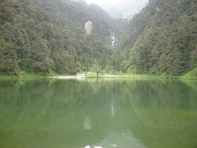
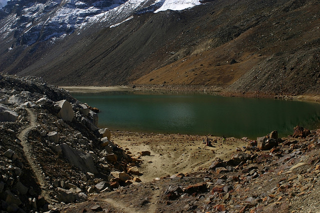
This spectacular and enchanting lake is situated at a distance of about 18 kms. from Gangotri, negotiable through rough and tough mountain trail. The trek is very tiring and there are testing moments even for a hardy trekker.

There is no facility of any kind on the way and one has to make all arrangements in advance. A local guide is a must. The lake is crystal clear with the mighty Thalayasagar (spahatikling) peak forming a splendid backdrop. The place is about 15000 feet of sea level and is the base camp for trekking to the Thalayasagar, Jogin, Bhrigupanth and other peaks. A crystal clear and transparent lake giving a feel of the chill waters, Kedar Tal is a spectacular creation of God that lies at an altitude of 4425 mts above sea level. This is the best place for a long trek.

Nachiketa Tal

Location

Adding to the list of tals or lakes in and around Gangotri is Nachiketa Tal. Another picturesque and splendid beauty of a crystal clear lake surrounded by thick dense forests and a mind blowing view of the mountain peaks, the Nachiketa Tal has a small little temple as the backdrop.

The lake is named after Nachiketa, son of Saint Uddalak. Nachiketa Tal can be reached after a 3-km long trek from Chaurangi Khal, which is a place 29 kms away from Uttarkashi. The Tal is a one-day attraction with no accommodation available around the place. One can either stay at Chaurangi Khal or get back to Uttarkashi after a day-long tour.

Kali River

Location

The Kali River originates from the Greater Himalayas at Kalapaani at an altitude of 3600 m, in the Pithoragarh District of Uttarakhand, India. The river is named after the Goddess Kali whose temple is situated in Kalapaani near the Lipu-Lekh pass at the border between India and Tibet. On its upper course, this river forms India's continuous eastern boundary with Nepal.

Chirkila Dam

Location

Uttaranchal is a land of rivers and mountains and thus holds a lot of potential for hydro electric power generation. A similar such initiative has resulted in the creation of the Chirkila dam on river Kali at Chirkila, a place 20 km ahead of Dharchula. The dam has a capacity of producing 1500 kW of energy. The dam is adjoined by a beautiful lake stretching up to 1 km in length. If news are to be believed, water sports may soon be started in the area by the Uttrakhand Government.