Historical

INS Khukri Memorial

Location

Indian Naval ship Khukri was a frigate of the Indian Navy. During the India Pakistan War in 1971 she fell prey to three torpedoes fired at her by a Pakistani Submarine She sank 40 nautical miles off the coast of Diu taking down with her a crew of l8 Officers and 176 sailors. Captain Mahendra Nath Mulla Mahavir Chakra (Post humous) of the Indian Navy, the then Commanding Officer of the ship, chose to go down with the warship. The heroic act of Captain Mulla and his valiant crew is a shining example of unyielding spirit and indomitable courage glorifying the heist traditions of the Indian Navy. There is an amphitheatre just adjoining the memorial.

Topic

Pani Kotha - Fortim do Mar

Location

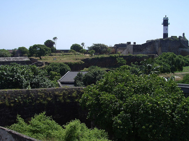
The Fortress of Panikotha is a magnificent stone structure in the sea, built right at the mouth of the creek. Approximately one nautical mile from the Diu jetty, it also has a light house and a small chaple dedicated to Our Lady of the Sea. Located in the middle of the sea, the fortress creates a beautiful view whether seen from the jetty, from the Fort, from the Village of Ghoghla or from Diu proper. Special light effects at night give it a mesmerizing beauty. To reach Panikotha, tourists boats are available.

Topic

Fort of Nani Daman

Location

The small fort situated at Nani Daman Jetty, with high stone walls enclose an area of 12,250 sq. mts. It has three bastions and two gateways. The most conspicuous part of the Fort is the giant gateway facing the river with a large statue of St. Jerome and side of the gateway. The imposing church of our Lady of the Sea is the principle building within the Fort.

The small fort with high stone walls encloses an area of 12,250 sq. meters. It has three bastions and two gateways.

Topic

Fort of Moti Daman

Location

The Fort of Moti Daman situated near Moti Daman Jetty. The massive fort that runs round the settlement like a girdle, dates back to 1559 AD. The colossal structure in the present form encompasses about 30,000 sq. mts. with 10 bastions and two gateways. The fort is protected by moat on the land side and also connects the river to the sea.

The massive Fort that runs round the settlement like a girdle, dates back to 1559 AD. The Colossal structure in the present form encompasses about 30,000 sq. Meters. with 10 bastions and two gateways. The Fort is protected by a moat on the land side and also connects the river to the sea. It is basically polygonal in plan with projections at regular intervals of about 500 feet and carrying splayed angular bastions.

Topic

Aihole

State

Aihole, situated on the banks of river Malaprabha, is a temple city comprises 100 of temples scattered in the city with superb architectures and sculptures. The prominent group of temples in Aihole is the Kontigudi group and the Galaganatha group of temples, although historians have divided the temples in 22 groups. The Kontigudi group of Aihole is a set of three temples consisting of the Lad Khan temple, Huchiappayyagudi temple and the Huchiappayya math. The Galaganatha group of Aihole has nearly 30 temples scattered on the bank of the river Malaprabha.

History

Chalukays first capital was Aihole.The first phase of the temple was built in 6th century CE and the second phase went on upto 12 th century CE .Here they built over 125 temples in various styles .The famous Chalukya King Pulakeshi II was follower of Jainism.Aihole inscription dated 634 CE, in Sanskrit language and old Kannada script.The prominent temple groups here are the Kontigudi group and the Galaganatha group of temples, although historians have divided all the temples into 22 groups.The cave temple of Ravana Phadi stands all by itself backed against the rocky hill out of which it has been carved.The Kontigudi group is a set of three temples consisting of the Lad Khan temple, Huchiappayyagudi temple and the Huchiappayya math.

The Galaganatha group has nearly 30 temples scattered on the bank of the river Malaprabha. Galaganatha temples are characterized by a curvilinear shikhara above the Garba Griha and images of the deities of Ganga and Yamuna at the entrance to the shrine.

This period saw the construction of great architectural wonders not only at Aihole but the whole region including Badami, Pattadakal, and other places.In the 17th century, Aurangzeb annexed the Deccan and made it a part of the Mughal Empire and Aihole, as a part of that region, came under the Mughal rule.The early Chalukya dynasty was ousted by its own district officers, the Rashtrakutas in AD 757. Later on, Aihole became a part of the Bahmani and other local Muslim dynasties.

Accessibility

By Air: The nearest airport in Karnataka is Bangalore (483 Kms.

By Rail: The nearest railhead is Bagalkot (43 Kms) on the Hubli-Sholapur line & is connected to Badami, Bangalore & Bijapur.

By Road: Aihole has convenient road connections to several important places around it: Aminagad (10 Kms), Badami (46 Kms), Bangalore (483 Kms), Bijapur (129 Kms), Hampi (146 Kms) and Pattadakal (17 Kms)

Shopping

Ilkal (36 Kms) is famous for its traditional handloom, art silk and silk sarees.

Accommodation

Tourist Rest House, Aihole, Hungund Taluk.
Tourist Rest Houses of Tourism Department.

District
Bagalkot
STD Code
08351
Termperature
Summer 30-40°C, Winter 10-22°C
Best time to visit
October to March
Famous For
Cradle Of Indian Temple Architecture

Panipat

State

Panipat, situated on the banks of the river Yamuna, is famous in Indian history as a place where the fate of great empires was decided more than once. It is the cradle of rich Indian cultural heritage, known for its handloom products. Today, Panipat has carved out its place among not only the first few fast developing cities, but also those having the highest per capita income in the country.

http://en.wikipedia.org/wiki/File:Tomb_of_Bu_Ali_Shah_Qalandar.jpg

District
Panipat District
STD Code
01742

Kurukshetra

State

Kurukshetra, meaning "the field of righteousness", is an ancient holy pilgrimage place owing to sacred association with the Vedas and the Vedic Culture. It was here that the battle of Mahabharat was fought and Lord Krishna preached his Philosophy of 'KARMA' as enshrined in the Holy Bhagwad-Gita, to Arjuna at Jyotisar. It is intimately related to the Aryan civilization and its growth along the Saraswati river.

History

Kurukshetra was named after the adventurous King Kuru, the ruler of the Bharat dynasty and the ancestor of the Pandavas and the Kauravas. The famous battle of Mahabharata between the Kauravas and the Pandavas is believed to have been fought on the land of Kurukshetra. This town is the birth place of the Bhagwad Gita and has the imprint of Lord Krishna’s footsteps.

Accessibility

Air: The nearest Airports are at Delhi and Chandigarh, which are connected to Kurukshetra by road and rail. Taxi services are also available from the airports. Delhi international airport is air connected to all major cities in India and abroad. Delhi is at a distance of 160 km from Kurukshetra, for which taxi charge is about Rs 2,000.

Rail: Kurukshetra is a major railway junction connected to all important railway stations in the country.

Road: Haryana Roadways Buses and other neighboring State Corporation buses connect Kurukshetra to other cities like Delhi, Chandigarh and other important places. Buses connecting to Delhi (160 km), Ambala (40 km) and Karnal (39 km) are frequently available. Private A/C buses charge about Rs 1,500 for Delhi-Kurukshetra trip.

Accommodation

One of the most valued duties of the host town of Kurukshetra has been to set up stations for halt of pilgrims.

Neelkanthi Krishna Dham Yatri Niwas:
This complex of Haryana Tourism is a recent construction and a few kilometres from the Railway Station as also a short drive from the National Highway#1.

Krishna Dham:
It has a central open courtyard, with guest rooms and dormitories built round it.

Panchayat Bhawan (Kurukshetra):
It also has accommodation wings.

Parakeet at Peepli:
Another tourist complex of Haryana Tourism where tourists may opt for air-conditioned accommodation is Parakeet at Pipli, some 5 km from Kurukshetra town. It lies on the National Highway number one, some 109 km from Chandigarh.

Attractions

Gita Jayanti Celebrations
Every year the birth of Srimad Bhagwad Gita is celebrated as the Gita Jayanti. A visit to Kurukshetra during the festival is an exhilarating and spiritual experience. The environment of the town is imbued with sanctity.

Celebrating this philosophy of selfless Karma, the Gita Jayanti presents Bhagwad Gita recitals, 'aarti' and 'deepdaan' at Brahma Sarovar, 'shloka' recital and quiz, 'shobha yatras' and seminars on the importance of Gita in today's world. Free medical camps, book exhibitions and 'bhajan' recitals in classical tradition are organized.

District
Kurukshetra District
STD Code
01744
Best time to visit
October to March
Famous For
Famous Hindu Pilgrimage

Faridkot

State

Faridkot, named after the famous Sufi Saint Baba Sheik Fariduddin Ganjshakar, is a historic city and is an important political and administrative city of the state. It has a rich history and was a princely state before the country’s independence and the origins of the place can be found to the Indus Valley Civilization. There are many sites in and around the city which speaks of the place’s history.

History

The name 'Faridkot' is derived from Baba Farid, the famous religious lover of God whose bani appears in the Guru Granth Sahib. Faridkot was feudlist province under British rule , but now it is a district in Punjab in independent India.

The ancestor of the Faridkot principality, Bhallan was an ardent follower of 6th Sikh Guru Har Gobind. He helped the Guru Har Gobind ji in the battle of Mehraj. He died issueless in 1643. Kapura, who was a nephew of Bhallan, succeeded him. Kapura founded the town of Kotkapura in 1661. Nawab Kapura was the Chaudhry of eighty-four villages. He was a Sikh but did not want to earn the ire of the Mughals and help Guru Gobind Singh Ji and fight with Mughals.

The famous last battle of Muktsar (Khidrane Di Dhaab) now a historic town, happened after Nawab Kapura declined Guru Gobind Singh's request to use his fort to fight Mughal Army. Otherwise the last war between Mughals and Guru Gobind Singh Ji was destined to happen at Kotkapura. Guru ji moved from Kotkapura to Dhilwan Kalan from there to Talwandi sabo via Guru ki Dhab. However, later in the battle of Muktsar in 1705, Nawab Kapura helped Guru Gobind Singh Ji in an underhand manner. Kapura was slain by Isa Khan Manj in 1708. He had three sons named Sukhia, Sema and Mukhia. Mukhia killed Isa Khan and took control of the entire area. Sema was also killed in this battle in 1710. Kapura's elder son Sukhia again came into power in 1720.

A dispute between grandsons of Kapura (sons of Sukhia) led to the division of the state in 1763. The older brother, Sardar Jodh Singh Brar, retained control of Kotkapura, and his younger brother, Sardar Hamir Singh Brar, was given Faridkot.

The state was captured in 1803 by Ranjit Singh, but was one of the Cis-Sutlej states that came under British influence after the 1809 Treaty of Amritsar. During the Sikh wars in 1845, Raja Pahar Singh aided the British, and was rewarded with an increase of territory. The state had an area of and its 642 square miles, and a population of 124,912 in 1901. It was bounded on the west and northeast by the British district of Ferozepore, and on the south by the state of Nabha. The last Ruler of Faridkot was Lt. HH Farzand-i-sadaat Nishan Hazrat-i-kaisar-i-hind Raja Sir Harindar Singh Brar Bans Bahadur.

Accessibility

Air: Faridkot's nearest Airports are Raja Sansi International Airport (125km) and Delhi International Airport (425km).

Rail: Faridkot is well connected to cities like New Delhi, Ferozepur, Bathinda and Jaipur by Train.

Road: It is also connected by road with Chandigarh (218 km), Ludhiana (105 km),Firozepur (32 km),Muktsar (45 km) and Bathinda (65 km).

District
Faridkot
STD Code
01639
Termperature
Summer 35-40°C, Winter 10-20°C
Best time to visit
Oct - Mar