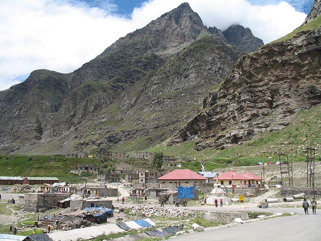
Koksar
Location
Perched at a height of 3140 m. It is 21kms. beyond Rohtang pass in Lahaul and is the coldest place in Lahaul. HRTC workshop, Rest House, police assistance and eating places are available during the season.
Topic
Perched at a height of 3140 m. It is 21kms. beyond Rohtang pass in Lahaul and is the coldest place in Lahaul. HRTC workshop, Rest House, police assistance and eating places are available during the season.
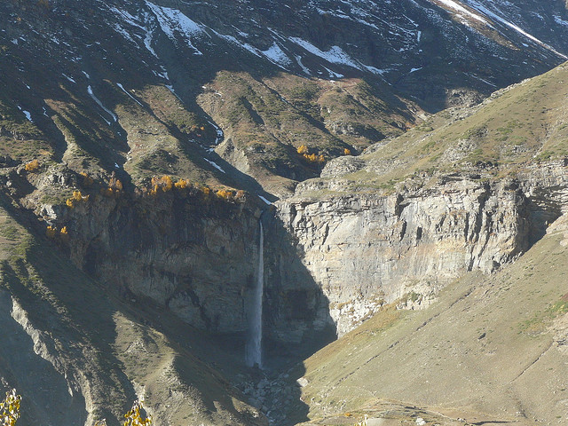
At an altitude of 3170 m, this place is famous because of a magnificent waterfall. Its fame is also because it happens to be the seat of God Geypan, a deity respected in the entire Lahaul valley.

A legendary place at the confluence of the Chandra & Bhaga rivers. Tandi is 8 kms. short of Keylong and is situated at the union of Chandra & Bhaga rivers. It is legendary place with beautiful surrounding. Tandi is 8 kms. short of Keylong and is situated at the confluence of Chandra & Bhaga rivers. A legend says that there were two lovers, Chandra being the daughter of the Moon and Bhaga the son of the Sun god. To perform there eternal marriage, they decided to climb to the Baralacha La & from there they ran in opposite directions.

It is almost 18 kms. from Keylong on the right bank of Chandra river. The location of royal houses of the village is very impressive. In the month of July a fair takes place when Lamas sing, dance & enjoy. The Gompa of this village has historical importance and the fair attracts a large number of visitors. The residence of the Thakur of Gondla is an eight-storey building, worth a visit. This is called Gondla Fort and was built in 1700 A.D.
On the bank of Chandra, 15 km from Koksar, every spring and autumn wild geese and ducks halt here on their way to and from Siberia.
This comprises four hamlets on the left bank of Spiti. Surrounded by hills on all sides, the natural beauty in Chango is worthseeing. The mixed culture of Buddhists and Hindu is also an added attraction.
This is a small village with fascinating views of the surroundings. Ghoral, Antelopes, Black & Red Bears are occasionaly encountered in higher ranges. ( 2,150 metres ) This village is situated between Taranda & Wangtu on the left bank of Satluj about 5 kms. above Wangtu. The scenery is enchanting. Ghoral , antelopes, black & red bears are seen sometimes in higher ranges.
Lush green fields orchards of apricot vineyards and almond trees, are to be seen on the route of Puh. Just 58 km from Powari along the NH-22, Puh has rest house and hotel facilities. Lush green fields, orchards of apricot, almond trees and vineyards, are to be seen on route to Puh. Just 58 km from Powari along the NH-22, Puh has rest house and basic hotel facilities.
http://www.flickr.com/photos/felixdance/5174509715/in/photostream

Located on the right bank of the Spiti river. It is the headquarters of sub tehsil Hangrang in Pooh sub-division. There is temple of 'Jamato' worth visiting.
Lippa, at an altitude of 2745 m, is famous for three Buddhist monasteries. These are dediacted to Galdang, Chhoiker Dunguir and Kangyar. Moreover, the nearby forest is also said to house the Ibex. Lippa can be accessed from Kalpa by the old Hindustan-Tibet road.